


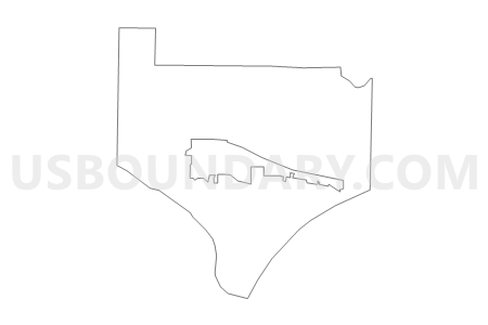
Clark Out Voting District, Pope County, Arkansas
About
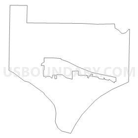
Outline
Summary
| Unique Area Identifier | 527733 |
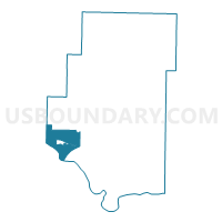
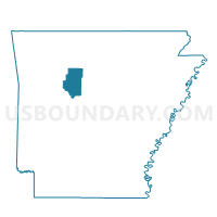
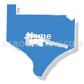
| Name | Clark Out Voting District |
| County | Pope County |
| State | Arkansas |
| Area (square miles) | 29.37 |
| Land Area (square miles) | 23.14 |
| Water Area (square miles) | 6.22 |
| % of Land Area | 78.81 |
| % of Water Area | 21.19 |
| Latitude of the Internal Point | 35.33536240 |
| Longtitude of the Internal Point | -93.23864560 |
Maps

Graphs
Select a template below for downloading or customizing gragh for Clark Out Voting District, Pope County, Arkansas


Neighbors
Neighoring Voting District (by Name) Neighboring Voting District on the Map
- Bayliss Voting District, Pope County, AR
- Dardanelle Out Voting District, Yell County, AR
- Delaware Voting District, Logan County, AR
- Dover Out Voting District, Pope County, AR
- Illinois NOWW Voting District, Pope County, AR
- London Ward 1 Voting District, Pope County, AR
- London Ward 2 Voting District, Pope County, AR
- London Ward 3 Voting District, Pope County, AR
- McKennon Voting District, Johnson County, AR
Top 10 Neighboring County Subdivision (by Population) Neighboring County Subdivision on the Map
- Illinois township, Pope County, AR (29,813)
- Dardanelle township, Yell County, AR (7,992)
- Dover township, Pope County, AR (5,704)
- Clark township, Pope County, AR (3,386)
- McKennon township, Johnson County, AR (944)
- Bayliss township, Pope County, AR (824)
- Delaware township, Logan County, AR (674)
Top 10 Neighboring Place (by Population) Neighboring Place on the Map
Top 10 Neighboring Unified School District (by Population) Neighboring Unified School District on the Map
- Russellville Schools, AR (37,630)
- Dardanelle Public Schools, AR (10,415)
- Dover School District, AR (7,969)
- Lamar School District, AR (6,860)
Top 10 Neighboring State Legislative District Lower Chamber (by Population) Neighboring State Legislative District Lower Chamber on the Map
- State House District 68, AR (32,119)
- State House District 69, AR (31,441)
- State House District 61, AR (29,993)
- State House District 70, AR (29,754)
- State House District 84, AR (25,531)
Top 10 Neighboring State Legislative District Upper Chamber (by Population) Neighboring State Legislative District Upper Chamber on the Map
Top 10 Neighboring 111th Congressional District (by Population) Neighboring 111th Congressional District on the Map
- Congressional District 3, AR (822,564)
- Congressional District 2, AR (751,377)
- Congressional District 4, AR (654,283)
Top 10 Neighboring Census Tract (by Population) Neighboring Census Tract on the Map
- Census Tract 9509, Pope County, AR (6,656)
- Census Tract 9522, Johnson County, AR (5,401)
- Census Tract 9514, Pope County, AR (4,903)
- Census Tract 9508, Pope County, AR (4,330)
- Census Tract 9501, Logan County, AR (4,084)
- Census Tract 9515.01, Pope County, AR (3,586)
- Census Tract 9523.02, Yell County, AR (2,941)